WV6148 : St.Aubin's Fort
St.Aubin's Fort
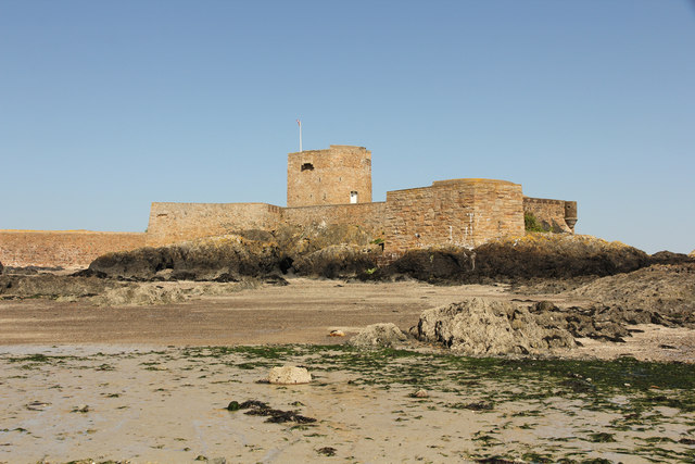
St.Aubin's Fort lies about 500m offshore from St.Aubin, built in 1542 to protect the harbour from pirates, it was further developed in the 18th and 19th centuries during the Anglo-French wars and again during the German occupation 1940-45. It can only be reached by the causeway at low tide.
![Creative Commons Licence [Some Rights Reserved]](http://s0.geograph.org.gg/img/somerights20.gif)
year taken
2015
| Find out how to reuse this Image For example on your webpage, blog, a forum, or Wikipedia. | |||||
| Suggest an Update to this Image | Contact the contributor | ||||
- Grid Square
- WV6148, 3 images (more nearby)
- Photographer
- Richard Croft (find more nearby)
- Image classification
- Geograph (First for WV6148)
- Date Taken
- Tuesday, 21 April, 2015 (more nearby)
- Submitted
- Saturday, 25 April, 2015
- Category
- Fortification (more nearby)
- Subject Location
-
MGRS:
 WV 6111 4829 [10m precision]
WGS84: 49:11.0621N 2:9.6842W - Photographer Location
-
MGRS: WV 6108 4822
- View Direction
- North-northeast (about 22 degrees)