WV2975 : Guernsey airport 1983
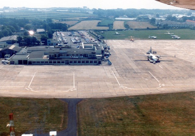
Guernsey airport 1983
From a scanned image.
The coordinates are approximate as there has been significant development of the airport.
The coordinates are approximate as there has been significant development of the airport.
![Creative Commons Licence [Some Rights Reserved]](http://s0.geograph.org.gg/img/somerights20.gif)
year taken
1983
| Find out how to reuse this Image For example on your webpage, blog, a forum, or Wikipedia. | |||||
| Suggest an Update to this Image | Contact the contributor | ||||
- Grid Square
- WV2975, 22 images (more nearby)
- Photographer
- Richard Hoare (find more nearby)
- Image classification
- Supplemental image
- Date Taken
- May 1983 (more nearby)
- Submitted
- Wednesday, 22 November, 2017
- Category
- Airport (more nearby)
- Subject Location
-
MGRS:
 WV 2930 7594 [10m precision]
WGS84: 49:26.1254N 2:35.7526W - Photographer Location
-
MGRS: WV 2925 7565
- View Direction
- NORTH (about 0 degrees)