WV2880 : Fort Hommet
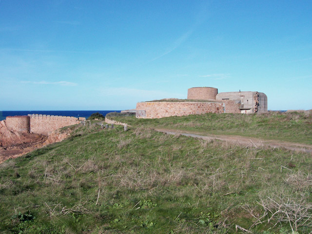
Fort Hommet
Originally built during the Victorian era as part of the coastal defence, the location was augmented by the Germans, who extended the building with rather insensitive concrete (right). The Victorian building has been restored (1980's) and further German fortifications also, more recently.
![Creative Commons Licence [Some Rights Reserved]](http://s0.geograph.org.gg/img/somerights20.gif)
year taken
2006
| Find out how to reuse this Image For example on your webpage, blog, a forum, or Wikipedia. | |||||
| Suggest an Update to this Image | Contact the contributor | ||||
- Grid Square
- WV2880, 3 images (more nearby)
- Photographer
- Jonathan Wilkins (find more nearby)
- Image classification
- Geograph (First for WV2880)
- Date Taken
- Wednesday, 1 November, 2006 (more nearby)
- Submitted
- Monday, 12 April, 2010
- Category
- Fort (more nearby)
- Subject Location
-
MGRS:
 WV 280 802 [100m precision]
WGS84: 49:28.4764N 2:36.7354W - Photographer Location
-
MGRS: WV 281 802
- View Direction
- North-northwest (about 337 degrees)