WV7052 : St. Catherine's Bay
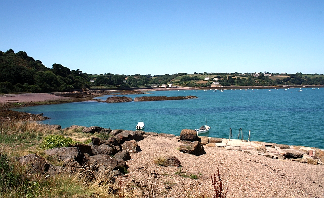
St. Catherine's Bay
The view across St Catherine's Bay from near the Archirondel Tower on the abandoned southern breakwater.
Looking towards the white painted tower near the lifeboat station.
Closer view: WV3374 : Coast east of Jerbourg Point
Looking towards the white painted tower near the lifeboat station.
Closer view: WV3374 : Coast east of Jerbourg Point
![Creative Commons Licence [Some Rights Reserved]](http://s0.geograph.org.gg/img/somerights20.gif)
year taken
2009
| Find out how to reuse this Image For example on your webpage, blog, a forum, or Wikipedia. | |||||
| Suggest an Update to this Image | Contact the contributor | ||||
- Grid Square
- WV7052, 16 images (more nearby)
- Photographer
- Bob Embleton (find more nearby)
- Image classification
- Supplemental image
- Date Taken
- Tuesday, 11 August, 2009 (more nearby)
- Submitted
- Saturday, 8 May, 2010
- Category
- Bay (more nearby)
- Subject Location
-
MGRS:
 WV 7065 5217 [10m precision]
WGS84: 49:13.0945N 2:1.7895W - Photographer Location
-
MGRS: WV 7108 5150
- View Direction
- North-northwest (about 337 degrees)