WV3378 : The harbour, St Peter Port, Guernsey
The harbour, St Peter Port, Guernsey
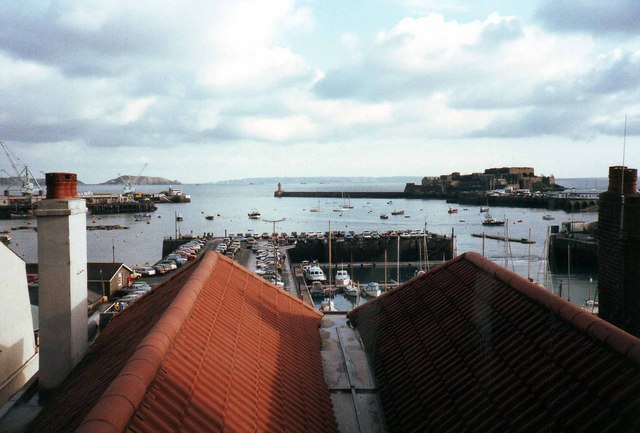
Looking east out over the harbour. Victoria Pier is in the centre of the picture, with Albert Pier to the right. In the right middle distance is Castle Cornet and Castle Emplacement. The large island in the far distance is Sark, with Jethou and Herm to the left hand side.
![Creative Commons Licence [Some Rights Reserved]](http://s0.geograph.org.gg/img/somerights20.gif)
year taken
1984
| Find out how to reuse this Image For example on your webpage, blog, a forum, or Wikipedia. | |||||
| Suggest an Update to this Image | Contact the contributor | ||||
- Grid Square
- WV3378, 43 images (more nearby)
- Photographer
- David P Howard (find more nearby)
- Image classification
- Geograph
- Date Taken
- December 1984 (more nearby)
- Submitted
- Thursday, 15 April, 2010
- Category
- Harbour (more nearby)
- Subject Location
-
MGRS:
 WV 3376 7826 [10m precision]
WGS84: 49:27.3635N 2:32.0500W - Photographer Location
-
MGRS: WV 3354 7829
- View Direction
- EAST (about 90 degrees)