WV7046 : Parish boundary stone
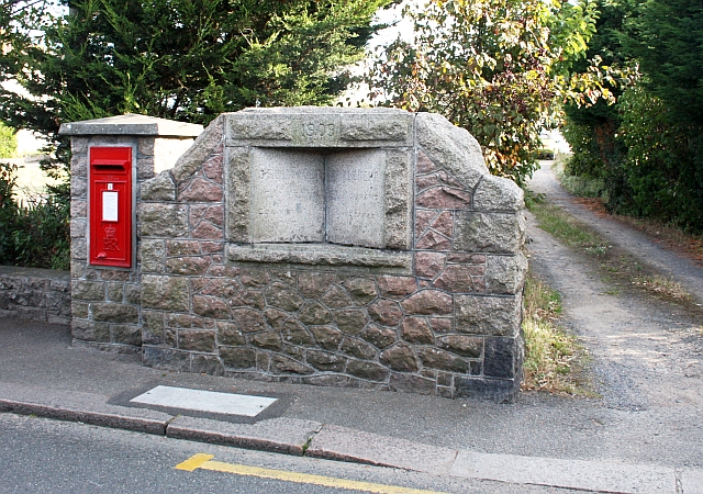
Parish boundary stone
Marking the boundary between Grouville on the left and St Clement on the right.
It gives the names of the Constable in each parish - in 1909.
It gives the names of the Constable in each parish - in 1909.
![Creative Commons Licence [Some Rights Reserved]](http://s0.geograph.org.gg/img/somerights20.gif)
year taken
2009
| Find out how to reuse this Image For example on your webpage, blog, a forum, or Wikipedia. | |||||
| Suggest an Update to this Image | Contact the contributor | ||||
- Grid Square
- WV7046, 20 images (more nearby)
- Photographer
- Bob Embleton (find more nearby)
- Image classification
- Geograph
- Date Taken
- Saturday, 8 August, 2009 (more nearby)
- Submitted
- Sunday, 23 May, 2010
- Category
- Boundary stone (more nearby)
- Subject Location
-
MGRS:
 WV 7017 4639 [10m precision]
WGS84: 49:9.9786N 2:2.2455W - Photographer Location
-
MGRS: WV 7017 4639
- View Direction
- SOUTH (about 180 degrees)