WV6548 : Streets of St Helier
Streets of St Helier
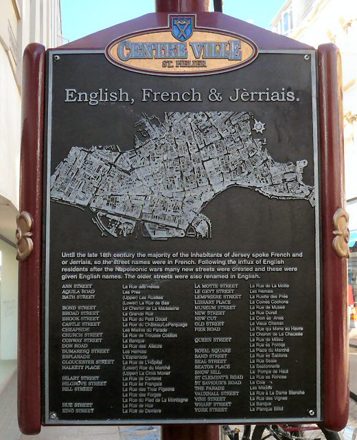
Sign on King Street (La Rue de Derriere) explaining the old and new names of streets in St Helier.
![Creative Commons Licence [Some Rights Reserved]](http://s0.geograph.org.gg/img/somerights20.gif)
year taken
2010
| Find out how to reuse this Image For example on your webpage, blog, a forum, or Wikipedia. | |||||
| Suggest an Update to this Image | Contact the contributor | ||||
- Grid Square
- WV6548, 39 images (more nearby)
- Photographer
- Gerald England (find more nearby)
- Image classification
- Supplemental image
- Date Taken
- Monday, 4 October, 2010 (more nearby)
- Submitted
- Sunday, 24 October, 2010
- Category
- Sign (more nearby)
- Subject Location
-
MGRS:
 WV 6507 4835 [10m precision]
WGS84: 49:11.0701N 2:6.4235W - Photographer Location
-
MGRS: WV 6507 4835
- View Direction
- North-northeast (about 22 degrees)