WV4774 : Derrible Bay, Sark
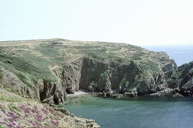
Derrible Bay, Sark
This picture clearly shows (just right of centre) the zig-zag path leading down the cliffside to the beach. In 1968, we thought nothing of skipping down this path!
![Creative Commons Licence [Some Rights Reserved]](http://s0.geograph.org.gg/img/somerights20.gif)
year taken
1968
| Find out how to reuse this Image For example on your webpage, blog, a forum, or Wikipedia. | |||||
| Suggest an Update to this Image | Contact the contributor | ||||
- Grid Square
- WV4774, 2 images (more nearby)
- Photographer
- John Rostron (find more nearby)
- Image classification
- Supplemental image
- Date Taken
- 24 July 1968 (more nearby)
- Submitted
- Monday, 19 April, 2010
- Category
- Coastal scenery (more nearby)
- Subject Location
-
MGRS:
 WV 4717 7495 [10m precision]
WGS84: 49:25.5237N 2:20.9721W - Photographer Location
-
MGRS: WV 4692 7498
- View Direction
- EAST (about 90 degrees)