WA5907 : Longis Bay and Fort Raz at low tide
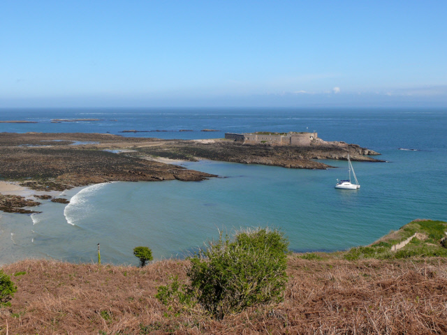
Longis Bay and Fort Raz at low tide
Alderney, Channel Islands. Fort Raz is accessed by a causeway which is covered at high tide. It had a number of guns on it to protect Fort Essex. The Germans used it quite extensively and fortified it in WWII. More recently it has been used as a private residence and a restaurant.
![Creative Commons Licence [Some Rights Reserved]](http://s0.geograph.org.gg/img/somerights20.gif)
year taken
2010
| Find out how to reuse this Image For example on your webpage, blog, a forum, or Wikipedia. | |||||
| Suggest an Update to this Image | Contact the contributor | ||||
- Grid Square
- WA5907, 10 images (more nearby)
- Photographer
- Peter (find more nearby)
- Image classification
- Geograph
- Date Taken
- Friday, 30 April, 2010 (more nearby)
- Submitted
- Tuesday, 21 December, 2010
- Category
- Fortification (more nearby)
- Subject Location
-
MGRS:
 WA 5997 0771 [10m precision]
WGS84: 49:43.1342N 2:10.0830W - Photographer Location
-
MGRS: WA 594 076
- View Direction
- EAST (about 90 degrees)