WV4576 : Saignie Bay and Les Autelets, Sark
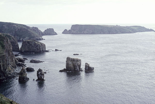
Saignie Bay and Les Autelets, Sark
On the more exposed north-western coast of Sark. The is land in the background is Brecqhou.
![Creative Commons Licence [Some Rights Reserved]](http://s0.geograph.org.gg/img/somerights20.gif)
year taken
1968
| Find out how to reuse this Image For example on your webpage, blog, a forum, or Wikipedia. | |||||
| Suggest an Update to this Image | Contact the contributor | ||||
- Grid Square
- WV4576, 6 images (more nearby)
- Photographer
- John Rostron (find more nearby)
- Image classification
- Geograph
- Date Taken
- 26 July 1968 (more nearby)
- Submitted
- Tuesday, 20 April, 2010
- Category
- Coastal scenery (more nearby)
- Subject Location
-
MGRS:
 WV 4568 7655 [10m precision]
WGS84: 49:26.3940N 2:22.1938W - Photographer Location
-
MGRS: WV 4592 7692
- View Direction
- South-southwest (about 202 degrees)