WV7048 : Fort Henry and outfall
Fort Henry and outfall
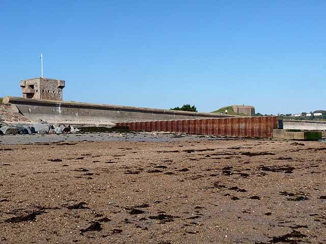
Fort Henry, one of the numerous 18th-19th century fortifications on Jersey stands behing the sewer outfall. A further fortification - this one dating from World War II - can be seen further along the bank.
![Creative Commons Licence [Some Rights Reserved]](http://s0.geograph.org.gg/img/somerights20.gif)
year taken
2011
| Find out how to reuse this Image For example on your webpage, blog, a forum, or Wikipedia. | |||||
| Suggest an Update to this Image | Contact the contributor | ||||
- Grid Square
- WV7048, 12 images (more nearby)
- Photographer
- Oliver Dixon (find more nearby)
- Image classification
- Geograph
- Date Taken
- Saturday, 15 October, 2011 (more nearby)
- Submitted
- Sunday, 22 January, 2012
- Category
- Tower (more nearby)
- Subject Location
-
MGRS:
 WV 7035 4858 [10m precision]
WGS84: 49:11.1592N 2:2.0744W - Photographer Location
-
MGRS: WV 7053 4851
- View Direction
- West-northwest (about 292 degrees)