WV7151 : Le Havre de Fer
Le Havre de Fer
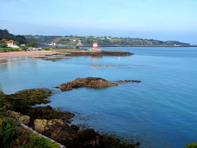
Archirondel Tower stands on the headland in the middle distance with the rest of St Catherine's Bay beyond.
![Creative Commons Licence [Some Rights Reserved]](http://s0.geograph.org.gg/img/somerights20.gif)
year taken
2011
| Find out how to reuse this Image For example on your webpage, blog, a forum, or Wikipedia. | |||||
| Suggest an Update to this Image | Contact the contributor | ||||
- Grid Square
- WV7151, 8 images (more nearby)
- Photographer
- Oliver Dixon (find more nearby)
- Image classification
- Geograph
- Date Taken
- Sunday, 16 October, 2011 (more nearby)
- Submitted
- Monday, 23 January, 2012
- Category
- Bay (more nearby)
- Subject Location
-
MGRS:
 WV 7113 5152 [10m precision]
WGS84: 49:12.7404N 2:1.4010W - Photographer Location
-
MGRS: WV 7131 5111
- View Direction
- North-northwest (about 337 degrees)