WV6049 : Western end of St Aubin's Bay
Western end of St Aubin's Bay
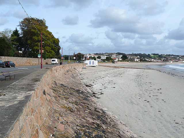
At this point the main road runs along the sea wall. Further east towards St Helier, the road diverges slightly from the coast and the front is flanked by a promenade and gardens. A slipway can be seen in the middle distance.
![Creative Commons Licence [Some Rights Reserved]](http://s0.geograph.org.gg/img/somerights20.gif)
year taken
2011
| Find out how to reuse this Image For example on your webpage, blog, a forum, or Wikipedia. | |||||
| Suggest an Update to this Image | Contact the contributor | ||||
- Grid Square
- WV6049, 9 images (more nearby)
- Photographer
- Oliver Dixon (find more nearby)
- Image classification
- Geograph (First for WV6049)
- Date Taken
- Tuesday, 18 October, 2011 (more nearby)
- Submitted
- Thursday, 26 January, 2012
- Category
- Beach (more nearby)
- Subject Location
-
MGRS:
 WV 6069 4913 [10m precision]
WGS84: 49:11.5180N 2:10.0224W - Photographer Location
-
MGRS: WV 6061 4902
- View Direction
- Northeast (about 45 degrees)