WV3979 : Rosaire (low water) landing, Herm 2008
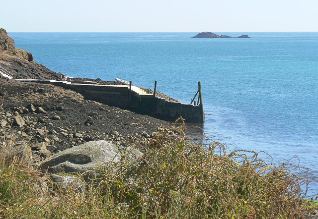
Rosaire (low water) landing, Herm 2008
This low water landing allows access to the ferries, but is about half a kilometre south of the main harbour.
![Creative Commons Licence [Some Rights Reserved]](http://s0.geograph.org.gg/img/somerights20.gif)
year taken
2008
| Find out how to reuse this Image For example on your webpage, blog, a forum, or Wikipedia. | |||||
| Suggest an Update to this Image | Contact the contributor | ||||
- Grid Square
- WV3979, 14 images (more nearby)
- Photographer
- John Rostron (find more nearby)
- Image classification
- Geograph
- Date Taken
- Tuesday, 22 July, 2008 (more nearby)
- Submitted
- Thursday, 22 April, 2010
- Category
- Harbour (more nearby)
- Subject Location
-
MGRS:
 WV 3958 7944 [10m precision]
WGS84: 49:27.9793N 2:27.2247W - Photographer Location
-
MGRS: WV 3963 7952
- View Direction
- South-southwest (about 202 degrees)