WV4775 : Leaving the Maseline Harbour, Sark
Leaving the Maseline Harbour, Sark
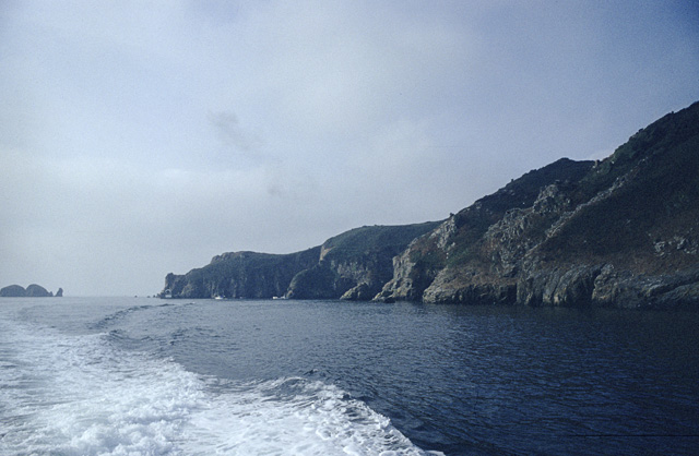
Taken from the boat heading for Herm, this shows the Maseline harbour at the extreme left of the promontory. The tunnel from the harbour is also just visible. The small islets to the left are the Burons.
![Creative Commons Licence [Some Rights Reserved]](http://s0.geograph.org.gg/img/somerights20.gif)
year taken
1968
| Find out how to reuse this Image For example on your webpage, blog, a forum, or Wikipedia. | |||||
| Suggest an Update to this Image | Contact the contributor | ||||
- Grid Square
- WV4775, 13 images (more nearby)
- Photographer
- John Rostron (find more nearby)
- Image classification
- Geograph
- Date Taken
- 28 July 1968 (more nearby)
- Submitted
- Thursday, 22 April, 2010
- Category
- Coastal scenery (more nearby)
- Subject Location
-
MGRS:
 WV 4756 7581 [10m precision]
WGS84: 49:25.9860N 2:20.6433W - Photographer Location
-
MGRS: WV 4757 7598
- View Direction
- SOUTH (about 180 degrees)