WV4574 : The Big Sark end of La Coupee
The Big Sark end of La Coupee
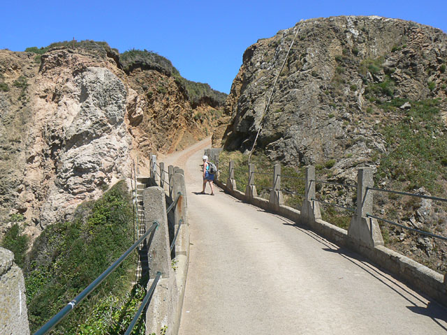
Taken from half way across La Coupee looking towards Big Sark. The access road runs though the cleft in the rock, seen from the opposite direction in WV4574 : Approaching la Coupee, Sark. To the left of the end of La Coupee itself is the access to the path down to Grand Greve, the first stage of a 100-metre (300-foot) access down.
![Creative Commons Licence [Some Rights Reserved]](http://s0.geograph.org.gg/img/somerights20.gif)
year taken
2008
| Find out how to reuse this Image For example on your webpage, blog, a forum, or Wikipedia. | |||||
| Suggest an Update to this Image | Contact the contributor | ||||
- Grid Square
- WV4574, 15 images (more nearby)
- Photographer
- John Rostron (find more nearby)
- Image classification
- Geograph
- Date Taken
- Sunday, 20 July, 2008 (more nearby)
- Submitted
- Friday, 23 April, 2010
- Category
- Island scenery (more nearby)
- Subject Location
-
MGRS:
 WV 4599 7449 [10m precision]
WGS84: 49:25.2809N 2:21.9516W - Photographer Location
-
MGRS: WV 4598 7447
- View Direction
- North-northeast (about 22 degrees)