WV2478 : Lihou Island and causeway
Lihou Island and causeway
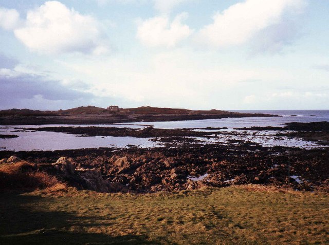
Looking NW towards Lihou Island from the end of Rue du Braye. The causeway which allows access to the island at low tide is partially visible. The tides come in very quickly and visitors have to watch carefully so as not to get stranded.
![Creative Commons Licence [Some Rights Reserved]](http://s0.geograph.org.gg/img/somerights20.gif)
year taken
1984
| Find out how to reuse this Image For example on your webpage, blog, a forum, or Wikipedia. | |||||
| Suggest an Update to this Image | Contact the contributor | ||||
- Grid Square
- WV2478, 18 images (more nearby)
- Photographer
- David P Howard (find more nearby)
- Image classification
- Geograph (First for WV2478)
- Date Taken
- December 1984 (more nearby)
- Submitted
- Thursday, 15 April, 2010
- Category
- Island (more nearby)
- Subject Location
-
MGRS:
 WV 2419 7871 [10m precision]
WGS84: 49:27.6338N 2:39.9712W - Photographer Location
-
MGRS: WV 2475 7830
- View Direction
- Northwest (about 315 degrees)