WA5706 : Standing Stone
Standing Stone
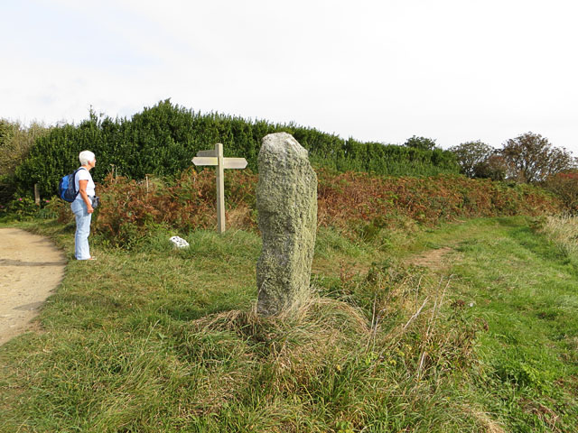
This standing stone, according to the Alderney Trail Guide, was once a cattle scratching post. It lies at the junction of the track from St Annes in the north and the coastal path along the cliff tops. The white stone near the signpost is a marker indicating the way to the wildlife bunker.
![Creative Commons Licence [Some Rights Reserved]](http://s0.geograph.org.gg/img/somerights20.gif)
year taken
2012
| Find out how to reuse this Image For example on your webpage, blog, a forum, or Wikipedia. | |||||
| Suggest an Update to this Image | Contact the contributor | ||||
- Grid Square
- WA5706, 15 images (more nearby)
- Photographer
- John Rostron (find more nearby)
- Image classification
- Geograph
- Date Taken
- Friday, 21 September, 2012 (more nearby)
- Submitted
- Sunday, 28 October, 2012
- Category
- Standing Stone (more nearby)
- Subject Location
-
MGRS:
 WA 57098 06205 [1m precision]
WGS84: 49:42.3388N 2:12.4865W - Photographer Location
-
MGRS: WA 5709 0621
- View Direction
- Southeast (about 135 degrees)