WA5507 : Access Track to Fort Clonque
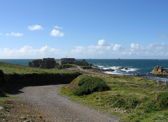
Access Track to Fort Clonque
At low tide, the entire causeway is visible.
![Creative Commons Licence [Some Rights Reserved]](http://s0.geograph.org.gg/img/somerights20.gif)
year taken
2012
| Find out how to reuse this Image For example on your webpage, blog, a forum, or Wikipedia. | |||||
| Suggest an Update to this Image | Contact the contributor | ||||
- Grid Square
- WA5507, 7 images (more nearby)
- Photographer
- Margaret Rostron
- Contributed by
- John Rostron (find more nearby)
- Image classification
- Geograph
- Date Taken
- Tuesday, 25 September, 2012 (more nearby)
- Submitted
- Sunday, 18 November, 2012
- Category
- Coastal (more nearby)
- Subject Location
-
MGRS:
 WA 5545 0713 [10m precision]
WGS84: 49:42.8472N 2:13.8499W - Photographer Location
-
MGRS: WA 55713 07087
- View Direction
- WEST (about 270 degrees)