WV6046 : Tour de Vinde, Noirmont
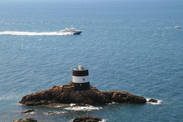
Tour de Vinde, Noirmont
A Martello tower constructed between 1808-1810 to command the approaches to St Aubin's Bay. Now used as a navigation marker. Also known as Noirmont Tower.
![Creative Commons Licence [Some Rights Reserved]](http://s0.geograph.org.gg/img/somerights20.gif)
year taken
2007
| Find out how to reuse this Image For example on your webpage, blog, a forum, or Wikipedia. | |||||
| Suggest an Update to this Image | Contact the contributor | ||||
- Grid Square
- WV6046, 31 images (more nearby)
- Photographer
- Chris Allen (find more nearby)
- Image classification
- Geograph
- Date Taken
- Friday, 20 July, 2007 (more nearby)
- Submitted
- Friday, 1 May, 2015
- Category
- Martello tower (more nearby)
- Subject Location
-
MGRS:
 WV 6065 4616 [10m precision]
WGS84: 49:9.9154N 2:10.0822W - Photographer Location
-
MGRS: WV 6065 4626
- View Direction
- SOUTH (about 180 degrees)