WV2478 : Observation tower on L'Eree Point
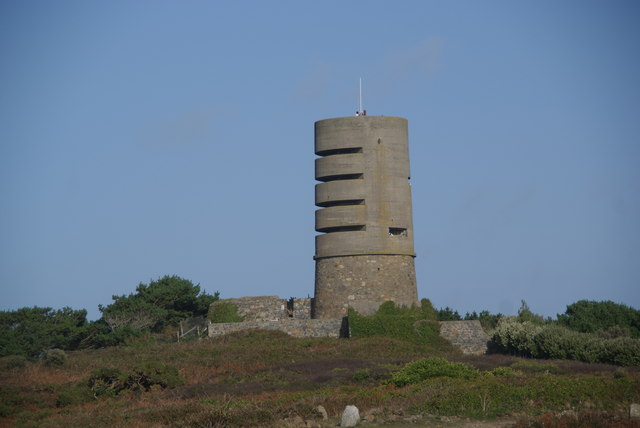
Observation tower on L'Eree Point
A WW2 relic.
![Creative Commons Licence [Some Rights Reserved]](http://s0.geograph.org.gg/img/somerights20.gif)
year taken
2009
| Find out how to reuse this Image For example on your webpage, blog, a forum, or Wikipedia. | |||||
| Suggest an Update to this Image | Contact the contributor | ||||
- Grid Square
- WV2478, 18 images (more nearby)
- Photographer
- Bill Boaden (find more nearby)
- Image classification
- Geograph
- Date Taken
- Saturday, 24 October, 2009 (more nearby)
- Submitted
- Monday, 24 August, 2015
- Category
- Fortification (more nearby)
- Subject Location
-
MGRS:
 WV 2489 7832 [10m precision]
WGS84: 49:27.4216N 2:39.3931W - Photographer Location
-
MGRS: WV 2479 7823
- View Direction
- Northeast (about 45 degrees)