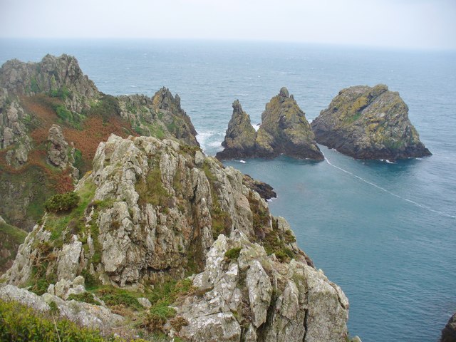
WV3374 : Jerbourg Point and Pea Stacks
Jerbourg Point and Pea Stacks
"The point marks the southeastern coast of the island of Guernsey. At 0.75 miles (1.2 km) in length, it is edged by steep cliffs which are 200 feet (60 m) in height. At the top of the plateau, the surface area can be as much as 300 feet (90 m) above sea level. The width of this landform at its northern and southern ends is a little more than 0.5 miles (0.8 km)".
Link Link
Link
Link
![Creative Commons Licence [Some Rights Reserved]](http://s0.geograph.org.gg/img/somerights20.gif)
year taken
2015
| Find out how to reuse this Image For example on your webpage, blog, a forum, or Wikipedia. | |||||
| Suggest an Update to this Image | Contact the contributor | ||||
- Grid Square
- WV3374, 20 images (more nearby)
- Photographer
- Colin Smith (find more nearby)
- Image classification
- Geograph
- Date Taken
- Sunday, 4 October, 2015 (more nearby)
- Submitted
- Saturday, 17 October, 2015
- Category
- Point (more nearby)
- Subject Location
-
MGRS:
 WV 3345 7427 [10m precision]
WGS84: 49:25.2113N 2:32.3268W - Photographer Location
-
MGRS: WV 3347 7435
- View Direction
- SOUTH (about 180 degrees)