WV2375 : Pleinmont - Fairy Ring
Pleinmont - Fairy Ring
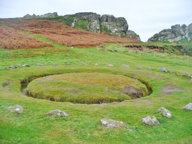
Aka La Table des Pions, this round ditch and stone circle surrounded a picnic table used by servants in the 18th century. They sat, with their legs in the ditch, facing into the "Fairy Ring". The servants were involved in a formal procession called La Chevauchee which involved checking of local boundaries and roads.
Link Link
Link
Link
![Creative Commons Licence [Some Rights Reserved]](http://s0.geograph.org.gg/img/somerights20.gif)
year taken
2015
| Find out how to reuse this Image For example on your webpage, blog, a forum, or Wikipedia. | |||||
| Suggest an Update to this Image | Contact the contributor | ||||
- Grid Square
- WV2375, 9 images (more nearby)
- Photographer
- Colin Smith (find more nearby)
- Image classification
- Geograph
- Date Taken
- Monday, 5 October, 2015 (more nearby)
- Submitted
- Sunday, 18 October, 2015
- Category
- Earthwork (more nearby)
- Subject Location
-
MGRS:
 WV 2373 7597 [10m precision]
WGS84: 49:26.1561N 2:40.3619W - Photographer Location
-
MGRS: WV 2374 7599
- View Direction
- South-southwest (about 202 degrees)