WV2576 : Fort Grey
Fort Grey
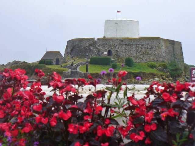
"Fort Grey, colloquially known as the "cup and saucer", is a Martello tower located on a rock in Rocquaine Bay. The French name of the rock upon which the tower was built is the Château de Rocquaine (Castle of Rocquaine); and in Guernésiais, Châté dé Rocquoïne. The rock was previously reputed to be the site of local witches' Sabbaths.
The existing fort, with its white tower was originally built as a defence by the British in 1804 during the Napoleonic Wars. It was named after Charles Grey, 1st Earl Grey, who was Governor of Guernsey 1797-1807".
Link Link
Link
The existing fort, with its white tower was originally built as a defence by the British in 1804 during the Napoleonic Wars. It was named after Charles Grey, 1st Earl Grey, who was Governor of Guernsey 1797-1807".
Link
![Creative Commons Licence [Some Rights Reserved]](http://s0.geograph.org.gg/img/somerights20.gif)
year taken
2015
| Find out how to reuse this Image For example on your webpage, blog, a forum, or Wikipedia. | |||||
| Suggest an Update to this Image | Contact the contributor | ||||
- Grid Square
- WV2576, 9 images (more nearby)
- Photographer
- Colin Smith (find more nearby)
- Image classification
- Geograph
- Date Taken
- Monday, 5 October, 2015 (more nearby)
- Submitted
- Monday, 19 October, 2015
- Category
- Fort (more nearby)
- Subject Location
-
MGRS:
 WV 2502 7634 [10m precision]
WGS84: 49:26.3527N 2:39.2930W - Photographer Location
-
MGRS: WV 2520 7632
- View Direction
- WEST (about 270 degrees)