WV3583 : Fort Doyle
Fort Doyle
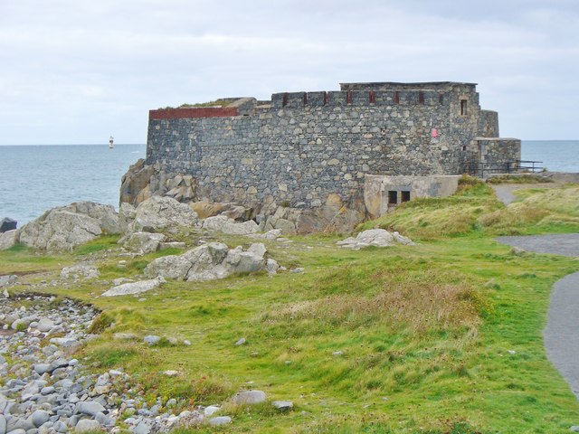
A Napoleonic War stone fortification (completed 1805) on Guernsey's north-east corner, Fort Doyle is named after Lt-General Doyle who was then the Lieutenant Governor of Guernsey. The fort was obsolete until 1909 when it housed an automatic light and foghorn. Fort Doyle was again fortified during WW2 when occupied by German forces.
Link Link
Link
Link
![Creative Commons Licence [Some Rights Reserved]](http://s0.geograph.org.gg/img/somerights20.gif)
year taken
2015
| Find out how to reuse this Image For example on your webpage, blog, a forum, or Wikipedia. | |||||
| Suggest an Update to this Image | Contact the contributor | ||||
- Grid Square
- WV3583, 11 images (more nearby)
- Photographer
- Colin Smith (find more nearby)
- Image classification
- Geograph
- Date Taken
- Wednesday, 7 October, 2015 (more nearby)
- Submitted
- Sunday, 25 October, 2015
- Category
- Fort (more nearby)
- Subject Location
-
MGRS:
 WV 3582 8382 [10m precision]
WGS84: 49:30.3570N 2:30.3144W - Photographer Location
-
MGRS: WV 3576 8378
- View Direction
- Northeast (about 45 degrees)