WA5606 : Alderney Airport
Alderney Airport
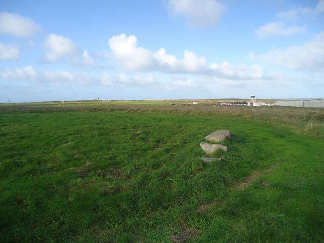
Looking towards the (rather modest) control tower from the highest point on Alderney. At least, it is recognised as such, although (as can be seen) the whole area is so flat that it is difficult to be sure that a trivially higher point is not lurking somewhere.
![Creative Commons Licence [Some Rights Reserved]](http://s0.geograph.org.gg/img/somerights20.gif)
year taken
2019
| Find out how to reuse this Image For example on your webpage, blog, a forum, or Wikipedia. | |||||
| Suggest an Update to this Image | Contact the contributor | ||||
- Grid Square
- WA5606, 12 images (more nearby)
- Photographer
- Michael Earnshaw
- Contributed by
- David Purchase (find more nearby)
- Image classification
- Geograph
- Date Taken
- Sunday, 6 October, 2019 (more nearby)
- Submitted
- Thursday, 14 November, 2019
- Category
- Airport (more nearby)
- Subject Location
-
MGRS:
 WA 566 065 [100m precision]
WGS84: 49:42.5008N 2:12.8983W - Photographer Location
-
MGRS: WA 569 065
- View Direction
- WEST (about 270 degrees)