WV6447 : Waterfront developments
Waterfront developments
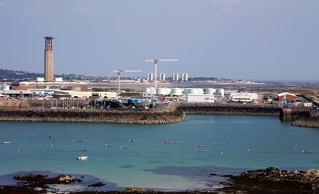
View from Elizabeth Castle across the newly created land built on the old rocky foreshore (shown as a blank white area on my 2003 Jersey OS map).
Beyond are the tower blocks of St Clements.
Beyond are the tower blocks of St Clements.
![Creative Commons Licence [Some Rights Reserved]](http://s0.geograph.org.gg/img/somerights20.gif)
year taken
2009
| Find out how to reuse this Image For example on your webpage, blog, a forum, or Wikipedia. | |||||
| Suggest an Update to this Image | Contact the contributor | ||||
- Grid Square
- WV6447, 29 images (more nearby)
- Photographer
- Bob Embleton (find more nearby)
- Image classification
- Supplemental image
- Date Taken
- Sunday, 9 August, 2009 (more nearby)
- Submitted
- Thursday, 6 May, 2010
- Category
- Building site (more nearby)
- Subject Location
-
MGRS:
 WV 6485 4708 [10m precision]
WGS84: 49:10.3861N 2:6.6169W - Photographer Location
-
MGRS: WV 6372 4739
- View Direction
- East-southeast (about 112 degrees)