WV7252 : Roundhead of St. Catherine's breakwater
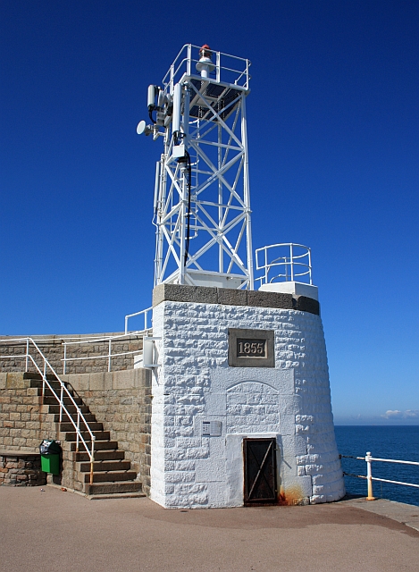
Roundhead of St. Catherine's breakwater
Work began on the breakwater in 1847 when Britain was fighting the Napolini wars and was completed with the construction of the large round end in 1855.
It was constructed by tipping a huge mound of rubble - a bund - on to the sea floor off the end of a wooden trestle.
On to this the walls of dressed stone blocks with rubble infill was built.
The plan was to have this northern breakwater accompanied by a southern one to create a huge "refuge" harbour from which the Royal Navy could challenge the French Fleet as soon as they left harbour.
By 1855 Britain and France had become allies against the Russians and the harbour was no longer needed.
The roundhead is some 606m out to sea and, after 150 years of buffeting by the sea, is beginning to subside.
It is thought the bund was not large enough and cavities have formed in the rubble inside the roundhead.
Link
Link
![Creative Commons Licence [Some Rights Reserved]](http://s0.geograph.org.gg/img/somerights20.gif)
year taken
2009
| Find out how to reuse this Image For example on your webpage, blog, a forum, or Wikipedia. | |||||
| Suggest an Update to this Image | Contact the contributor | ||||
- Grid Square
- WV7252, 5 images (more nearby)
- Photographer
- Bob Embleton (find more nearby)
- Image classification
- Geograph (First for WV7252)
- Date Taken
- Tuesday, 11 August, 2009 (more nearby)
- Submitted
- Friday, 7 May, 2010
- Category
- Breakwater (more nearby)
- Subject Location
-
MGRS:
 WV 7205 5264 [10m precision]
WGS84: 49:13.3383N 2:0.6311W - Photographer Location
-
MGRS: WV 7204 5262
- View Direction
- North-northeast (about 22 degrees)