WV7152 : St. Catherine's Breakwater
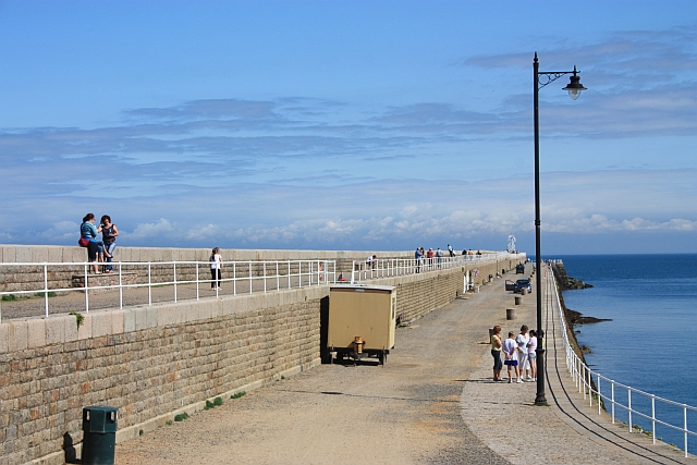
St. Catherine's Breakwater
Looking along the 600m breakwater built between 1847 and 1855.
![Creative Commons Licence [Some Rights Reserved]](http://s0.geograph.org.gg/img/somerights20.gif)
year taken
2009
| Find out how to reuse this Image For example on your webpage, blog, a forum, or Wikipedia. | |||||
| Suggest an Update to this Image | Contact the contributor | ||||
- Grid Square
- WV7152, 30 images (more nearby)
- Photographer
- Bob Embleton (find more nearby)
- Image classification
- Geograph
- Date Taken
- Tuesday, 11 August, 2009 (more nearby)
- Submitted
- Friday, 7 May, 2010
- Category
- Breakwater (more nearby)
- Subject Location
-
MGRS:
 WV 7192 5268 [10m precision]
WGS84: 49:13.3608N 2:0.7378W - Photographer Location
-
MGRS: WV 7148 5289
- View Direction
- East-southeast (about 112 degrees)