WV7151 : St. Catherine's southern Breakwater
St. Catherine's southern Breakwater
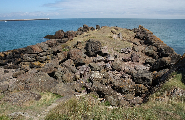
The start of the southern breakwater which would (with the completed northern breakwater) have created a huge "refuge" harbour from which the Royal Navy could blockade the French ports during times of conflict.
Work ceased when the French became allies of Britain in the 1850s.
The northern breakwater can be seen stretching out some 600m into the sea on the left of the picture.
Work ceased when the French became allies of Britain in the 1850s.
The northern breakwater can be seen stretching out some 600m into the sea on the left of the picture.
![Creative Commons Licence [Some Rights Reserved]](http://s0.geograph.org.gg/img/somerights20.gif)
year taken
2009
| Find out how to reuse this Image For example on your webpage, blog, a forum, or Wikipedia. | |||||
| Suggest an Update to this Image | Contact the contributor | ||||
- Grid Square
- WV7151, 8 images (more nearby)
- Photographer
- Bob Embleton (find more nearby)
- Image classification
- Geograph
- Date Taken
- Tuesday, 11 August, 2009 (more nearby)
- Submitted
- Friday, 7 May, 2010
- Category
- Breakwater (more nearby)
- Subject Location
-
MGRS:
 WV 7115 5152 [10m precision]
WGS84: 49:12.7402N 2:1.3845W - Photographer Location
-
MGRS: WV 7109 5150
- View Direction
- East-northeast (about 67 degrees)