WV7051 : Path to the Archirondel Tower
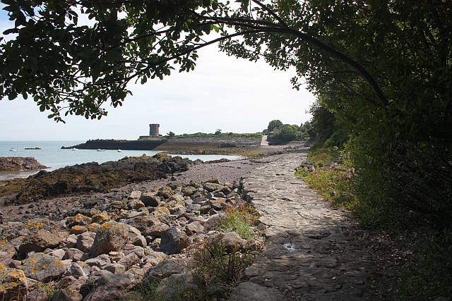
Path to the Archirondel Tower
The path takes one alongside St. Catherine's Bay.
The tower was built in 1794, but modified by the German occupying forces during the second world war.
The tower was built in 1794, but modified by the German occupying forces during the second world war.
![Creative Commons Licence [Some Rights Reserved]](http://s0.geograph.org.gg/img/somerights20.gif)
year taken
2009
| Find out how to reuse this Image For example on your webpage, blog, a forum, or Wikipedia. | |||||
| Suggest an Update to this Image | Contact the contributor | ||||
- Grid Square
- WV7051, 14 images (more nearby)
- Photographer
- Bob Embleton (find more nearby)
- Image classification
- Geograph (First for WV7051)
- Date Taken
- Tuesday, 11 August, 2009 (more nearby)
- Submitted
- Friday, 7 May, 2010
- Category
- Path (more nearby)
- Subject Location
-
MGRS:
 WV 7090 5157 [10m precision]
WGS84: 49:12.7689N 2:1.5899W - Photographer Location
-
MGRS: WV 7086 5166
- View Direction
- South-southeast (about 157 degrees)