WV3484 : Fort Le Marchant
Fort Le Marchant
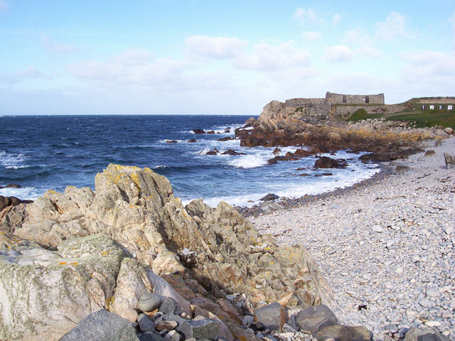
Looking across the little bay and rifle range to the fort. In Napoleonic times this was one of the principal defences of the island, and a large barracks was also part of the complex - though now demolished.
![Creative Commons Licence [Some Rights Reserved]](http://s0.geograph.org.gg/img/somerights20.gif)
year taken
2006
| Find out how to reuse this Image For example on your webpage, blog, a forum, or Wikipedia. | |||||
| Suggest an Update to this Image | Contact the contributor | ||||
- Grid Square
- WV3484, 5 images (more nearby)
- Photographer
- Jonathan Wilkins (find more nearby)
- Image classification
- Geograph (First for WV3484)
- Date Taken
- Tuesday, 31 October, 2006 (more nearby)
- Submitted
- Tuesday, 13 April, 2010
- Category
- Fort (more nearby)
- Subject Location
-
MGRS:
 WV 348 841 [100m precision]
WGS84: 49:30.5169N 2:31.1084W - Photographer Location
-
MGRS: WV 348 839
- View Direction
- NORTH (about 0 degrees)