WV3583 : Fort Doyle headland
Fort Doyle headland
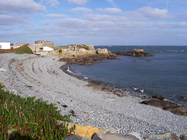
A view of the small bay known as Fontaine 'es Boeufs with the headland and for at the north end. Typical of this part of the island, the grey, pebbly beach arises from the underlying rock, which is a diorite which does not produce a quartz-rich sand when weathered.
![Creative Commons Licence [Some Rights Reserved]](http://s0.geograph.org.gg/img/somerights20.gif)
year taken
2006
| Find out how to reuse this Image For example on your webpage, blog, a forum, or Wikipedia. | |||||
| Suggest an Update to this Image | Contact the contributor | ||||
- Grid Square
- WV3583, 11 images (more nearby)
- Photographer
- Jonathan Wilkins (find more nearby)
- Image classification
- Geograph (First for WV3583)
- Date Taken
- Tuesday, 31 October, 2006 (more nearby)
- Submitted
- Tuesday, 13 April, 2010
- Category
- Bay (more nearby)
- Subject Location
-
MGRS:
 WV 358 837 [100m precision]
WGS84: 49:30.3409N 2:30.3145W - Photographer Location
-
MGRS: WV 357 837
- View Direction
- North-northeast (about 22 degrees)