WV5447 : Causeway path, La Corbiere lighthouse
Causeway path, La Corbiere lighthouse
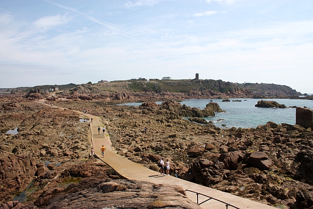
Looking back from the lighthouse rock towards the mainland and the huge German occupation coastal lookout.
When the tide is out hundreds of tourists cross over the causeway to see the lighthouse (on the rocks above and behind the photographer).
When the tide is out hundreds of tourists cross over the causeway to see the lighthouse (on the rocks above and behind the photographer).
![Creative Commons Licence [Some Rights Reserved]](http://s0.geograph.org.gg/img/somerights20.gif)
year taken
2009
| Find out how to reuse this Image For example on your webpage, blog, a forum, or Wikipedia. | |||||
| Suggest an Update to this Image | Contact the contributor | ||||
- Grid Square
- WV5447, 24 images (more nearby)
- Photographer
- Bob Embleton (find more nearby)
- Image classification
- Geograph
- Date Taken
- Tuesday, 18 August, 2009 (more nearby)
- Submitted
- Thursday, 13 May, 2010
- Category
- causeway (more nearby)
- Subject Location
-
MGRS:
 WV 5490 4787 [10m precision]
WGS84: 49:10.8707N 2:14.8003W - Photographer Location
-
MGRS: WV 5468 4773
- View Direction
- East-northeast (about 67 degrees)