WV6556 : Split in the path at La Belle Houge
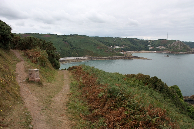
Split in the path at La Belle Houge
The upper path to the left takes one to the car park;
the lower path to La Crete Fort (the next headland) and the Bonne Nuit jetty (before the second headland).
the lower path to La Crete Fort (the next headland) and the Bonne Nuit jetty (before the second headland).
![Creative Commons Licence [Some Rights Reserved]](http://s0.geograph.org.gg/img/somerights20.gif)
year taken
2009
| Find out how to reuse this Image For example on your webpage, blog, a forum, or Wikipedia. | |||||
| Suggest an Update to this Image | Contact the contributor | ||||
- Grid Square
- WV6556, 2 images (more nearby)
- Photographer
- Bob Embleton (find more nearby)
- Image classification
- Geograph (First for WV6556)
- Date Taken
- Monday, 17 August, 2009 (more nearby)
- Submitted
- Thursday, 13 May, 2010
- Category
- Path (more nearby)
- Subject Location
-
MGRS:
 WV 6539 5610 [10m precision]
WGS84: 49:15.2503N 2:6.0843W - Photographer Location
-
MGRS: WV 6540 5611
- View Direction
- Southwest (about 225 degrees)