WV6046 : Armoured range finder, Noirmont Point
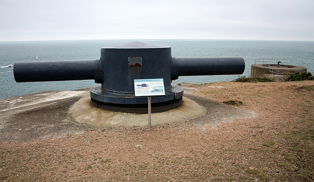
Armoured range finder, Noirmont Point
A German Occupation 6 metre wide stereoscopic range finder.
After the war the arms of the range finder were thrown over the cliffs but were recovered in 1996 and the recreated device re-installed in 1997.
After the war the arms of the range finder were thrown over the cliffs but were recovered in 1996 and the recreated device re-installed in 1997.
![Creative Commons Licence [Some Rights Reserved]](http://s0.geograph.org.gg/img/somerights20.gif)
year taken
2009
| Find out how to reuse this Image For example on your webpage, blog, a forum, or Wikipedia. | |||||
| Suggest an Update to this Image | Contact the contributor | ||||
- Grid Square
- WV6046, 31 images (more nearby)
- Photographer
- Bob Embleton (find more nearby)
- Image classification
- Geograph
- Date Taken
- Wednesday, 12 August, 2009 (more nearby)
- Submitted
- Thursday, 27 May, 2010
- Category
- WW II defences (more nearby)
- Subject Location
-
MGRS:
 WV 6052 4634 [10m precision]
WGS84: 49:10.0133N 2:10.1876W - Photographer Location
-
MGRS: WV 6052 4636
- View Direction
- SOUTH (about 180 degrees)