WV4574 : Approaching la Coupee, Sark
Approaching la Coupee, Sark
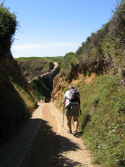
The road approaching La Coupee passes through this high-sided stretch, and is quite steep at this point. As it opens up there is access to the path down the cliff. Although I had happily climbed up and down this path in 1968, 1988 and 1989, I decided to give it a miss in 2008.
![Creative Commons Licence [Some Rights Reserved]](http://s0.geograph.org.gg/img/somerights20.gif)
year taken
2008
| Find out how to reuse this Image For example on your webpage, blog, a forum, or Wikipedia. | |||||
| Suggest an Update to this Image | Contact the contributor | ||||
- Grid Square
- WV4574, 15 images (more nearby)
- Photographer
- Margaret Rostron
- Contributed by
- John Rostron (find more nearby)
- Image classification
- Geograph
- Date Taken
- Sunday, 20 July, 2008 (more nearby)
- Submitted
- Thursday, 22 April, 2010
- Category
- Island scenery (more nearby)
- Subject Location
-
MGRS:
 WV 4599 7449 [10m precision]
WGS84: 49:25.2809N 2:21.9516W - Photographer Location
-
MGRS: WV 4600 7450
- View Direction
- Southwest (about 225 degrees)