WV6349 : National Cycle Network sign
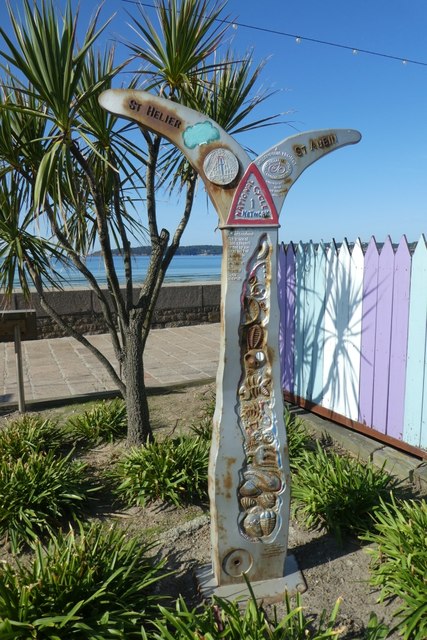
National Cycle Network sign
Situated on the coastal path between St. Helier and St. Aubin.
![Creative Commons Licence [Some Rights Reserved]](http://s0.geograph.org.gg/img/somerights20.gif)
year taken
2019
| Find out how to reuse this Image For example on your webpage, blog, a forum, or Wikipedia. | |||||
| Suggest an Update to this Image | Contact the contributor | ||||
- Grid Square
- WV6349, 11 images (more nearby)
- Photographer
- DS Pugh (find more nearby)
- Image classification
- Supplemental image
- Date Taken
- Friday, 30 August, 2019 (more nearby)
- Submitted
- Thursday, 21 May, 2020
- Category
- Sign (more nearby)
- Subject Location
-
MGRS:
 WV 6346 4939 [10m precision]
WGS84: 49:11.6414N 2:7.7391W - Photographer Location
-
MGRS: WV 63463 49396
- View Direction
- South-southwest (about 202 degrees)