WV6547 : Water levels meeting
Water levels meeting
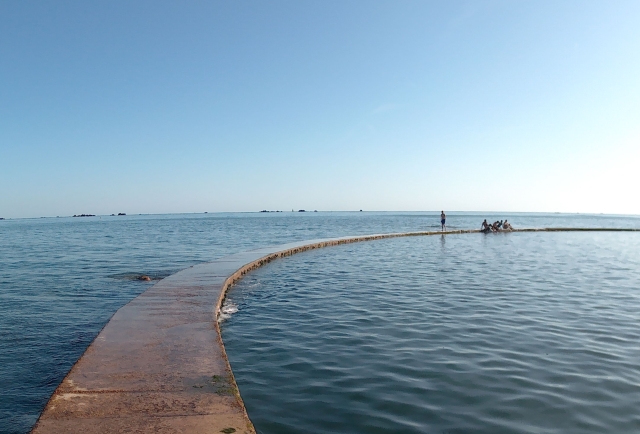
Looking along the wall of the Havre des Pas Lido. The sea is on the left, the lido on the right. Within minutes, the tide was over the wall.
![Creative Commons Licence [Some Rights Reserved]](http://s0.geograph.org.gg/img/somerights20.gif)
year taken
2019
| Find out how to reuse this Image For example on your webpage, blog, a forum, or Wikipedia. | |||||
| Suggest an Update to this Image | Contact the contributor | ||||
- Grid Square
- WV6547, 51 images (more nearby)
- Photographer
- DS Pugh (find more nearby)
- Image classification
- Geograph
- Date Taken
- Sunday, 1 September, 2019 (more nearby)
- Submitted
- Friday, 22 May, 2020
- Category
- Lido (more nearby)
- Subject Location
-
MGRS:
 WV 6565 4739 [10m precision]
WGS84: 49:10.5483N 2:5.9555W - Photographer Location
-
MGRS: WV 6565 4742
- View Direction
- SOUTH (about 180 degrees)