WV5554 : Cueillette De Millais footpath
Cueillette De Millais footpath
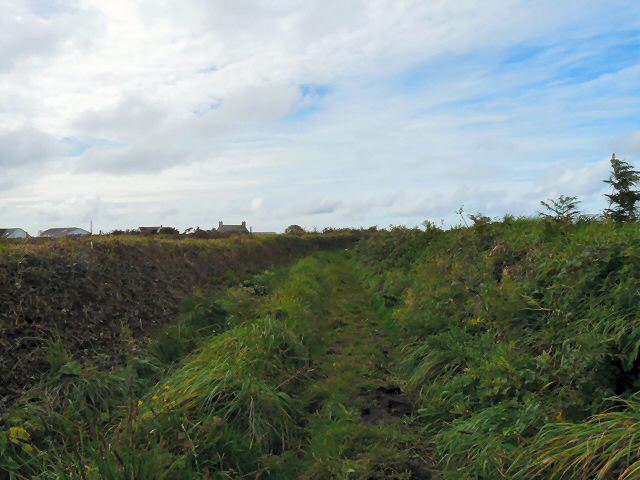
This footpath in the Cueillette De Millais connects La Route des Landes to La Rue Freule. It has steep banks either side and appears to be used mainly by horse riders judging by the many hoofprints in the mud.
![Creative Commons Licence [Some Rights Reserved]](http://s0.geograph.org.gg/img/somerights20.gif)
year taken
2010
| Find out how to reuse this Image For example on your webpage, blog, a forum, or Wikipedia. | |||||
| Suggest an Update to this Image | Contact the contributor | ||||
- Grid Square
- WV5554, 45 images (more nearby)
- Photographer
- Gerald England (find more nearby)
- Image classification
- Geograph
- Date Taken
- Sunday, 3 October, 2010 (more nearby)
- Submitted
- Saturday, 16 October, 2010
- Category
- Footpath (more nearby)
- Subject Location
-
MGRS:
 WV 5539 5494 [10m precision]
WGS84: 49:14.6835N 2:14.3384W - Photographer Location
-
MGRS: WV 5542 5494
- View Direction
- WEST (about 270 degrees)