WV5848 : St Brelade's Church
St Brelade's Church
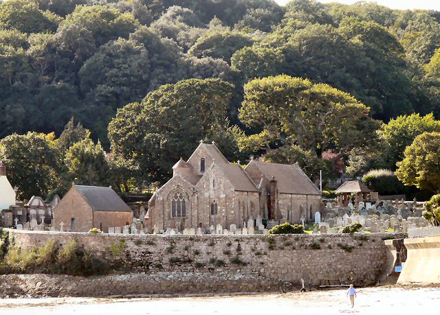
The date of the present church is unknown, but it is mentioned in deeds of patronage. In AD 1035, Robert of Normandy confirmed the patronage of the church to the monastery of Montivilliers, which shows that the church was here before 1035. The chancel is the oldest part of the building. The original building extended some six feet into the nave. It was then only a small monastic chapel. Early in the 12th century it became a parish church, so additions were made; and in the 14th15th centuries, the roof was raised some two-and-a-half feet higher to a Gothic pitch. Information from Wikipedia Link Church website Link
![Creative Commons Licence [Some Rights Reserved]](http://s0.geograph.org.gg/img/somerights20.gif)
year taken
2010
| Find out how to reuse this Image For example on your webpage, blog, a forum, or Wikipedia. | |||||
| Suggest an Update to this Image | Contact the contributor | ||||
- Grid Square
- WV5848, 47 images (more nearby)
- Photographer
- Gerald England (find more nearby)
- Image classification
- Geograph
- Date Taken
- Friday, 8 October, 2010 (more nearby)
- Submitted
- Monday, 15 November, 2010
- Category
- Church (more nearby)
- Subject Location
-
MGRS:
 WV 5809 4823 [10m precision]
WGS84: 49:11.0474N 2:12.1711W - Photographer Location
-
MGRS: WV 5825 4834
- View Direction
- West-southwest (about 247 degrees)