WV7048 : World War II Fortification
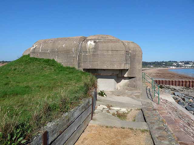
World War II Fortification
On the shore of La Baie du Vieux Château (Royal Bay of Grouville) just north of Fort Henry.
![Creative Commons Licence [Some Rights Reserved]](http://s0.geograph.org.gg/img/somerights20.gif)
year taken
2011
| Find out how to reuse this Image For example on your webpage, blog, a forum, or Wikipedia. | |||||
| Suggest an Update to this Image | Contact the contributor | ||||
- Grid Square
- WV7048, 12 images (more nearby)
- Photographer
- Oliver Dixon (find more nearby)
- Image classification
- Geograph
- Date Taken
- Saturday, 15 October, 2011 (more nearby)
- Submitted
- Sunday, 22 January, 2012
- Category
- WW II defences (more nearby)
- Subject Location
-
MGRS:
 WV 7041 4861 [10m precision]
WGS84: 49:11.1750N 2:2.0247W - Photographer Location
-
MGRS: WV 7045 4851
- View Direction
- North-northwest (about 337 degrees)