WV5955 : L'Ile Agois
L'Ile Agois
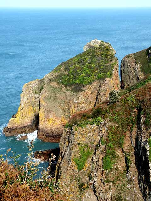
L'Ile Agois is a sea stack separated from the main line of cliffs by a narrow cleft.
![Creative Commons Licence [Some Rights Reserved]](http://s0.geograph.org.gg/img/somerights20.gif)
year taken
2011
| Find out how to reuse this Image For example on your webpage, blog, a forum, or Wikipedia. | |||||
| Suggest an Update to this Image | Contact the contributor | ||||
- Grid Square
- WV5955, 6 images (more nearby)
- Photographer
- Oliver Dixon (find more nearby)
- Image classification
- Geograph
- Date Taken
- Monday, 17 October, 2011 (more nearby)
- Submitted
- Tuesday, 24 January, 2012
- Category
- Cliffs (more nearby)
- Subject Location
-
MGRS:
 WV 5953 5546 [10m precision]
WGS84: 49:14.9408N 2:10.9212W - Photographer Location
-
MGRS: WV 5945 5522
- View Direction
- North-northeast (about 22 degrees)