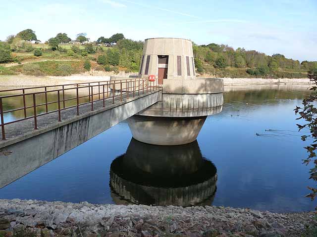
WV6949 : Control tower, Queens Valley Reservoir
Control tower, Queens Valley Reservoir
Queens Valley Reservoir was completed in 1991 and serves not only for Jersey's water supply, but also as a recreational site and nature reserve.
![Creative Commons Licence [Some Rights Reserved]](http://s0.geograph.org.gg/img/somerights20.gif)
year taken
2011
| Find out how to reuse this Image For example on your webpage, blog, a forum, or Wikipedia. | |||||
| Suggest an Update to this Image | Contact the contributor | ||||
- Grid Square
- WV6949, 11 images (more nearby)
- Photographer
- Oliver Dixon (find more nearby)
- Image classification
- Geograph
- Date Taken
- Thursday, 20 October, 2011 (more nearby)
- Submitted
- Sunday, 29 January, 2012
- Category
- Reservoir (more nearby)
- Subject Location
-
MGRS:
 WV 6938 4944 [10m precision]
WGS84: 49:11.6299N 2:2.8640W - Photographer Location
-
MGRS: WV 6939 4940
- View Direction
- NORTH (about 0 degrees)